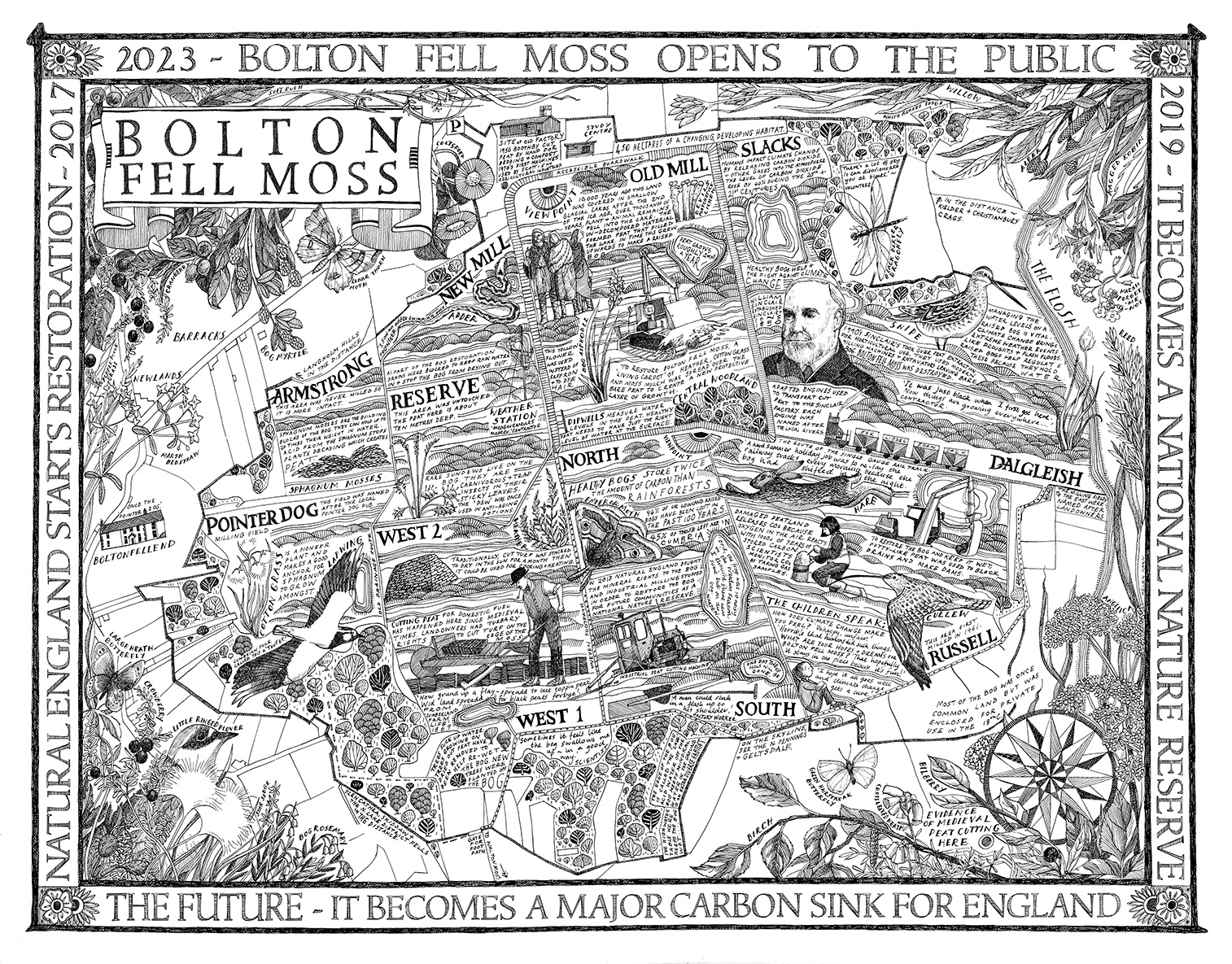
A Map of Bolton Fell Moss commissioned as part of the Moss of Many Layers project, led by the University of Cumbria in partnership with scientists from the Centre for National Parks and Protected Areas, artists from the PLACE Collective (of which I am a member) and the landowners, Natural England. During my involvment in the project I was made an Honorary Research Fellow of the University.
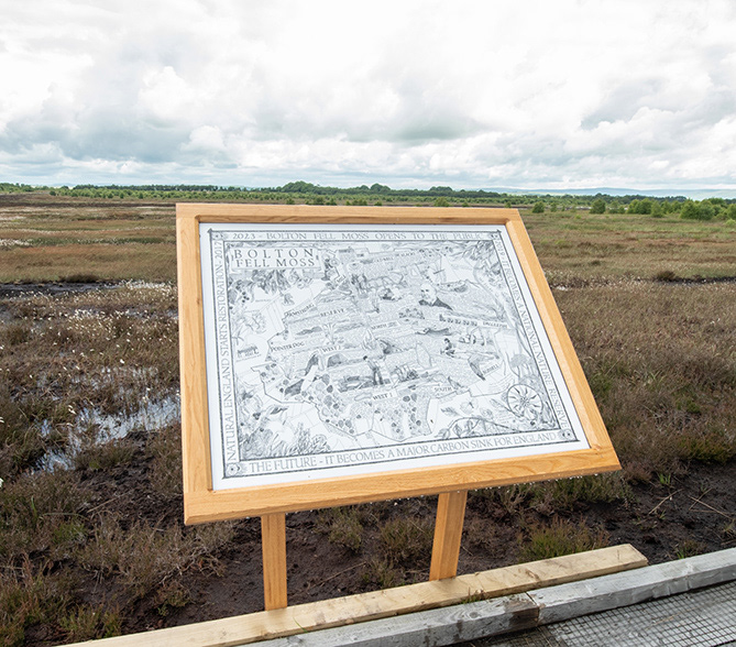
The map shows the 421 hectares of Bolton Fell Moss in Cumbria that was, until recently, being milled for horticultural peat. This left the bog environmentally devastated. Since 2017 though, it has been in the process of restoration by Natural England and is set to become a major National Nature Reserve.
The map shows a landscape layered with stories across time - the peat formation 10,000 years ago, historic domestic cutting for fuel, more recent industrial milling for horticultural peat and the current scientific processes of peat restoration. Alongside these stories are those collected from the people who live near or work on the bog and the voices of local children and their hopes for the future of the Moss fighting climate change as a carbon capture sink.
The border and design elements were informed by original turn-of-the-century adverts promoting the horticultural products of Sinclairs - the company last involved in milling Bolton Fell.
Rendered in pen and ink and about A1 in size, it will eventually be used in signage and for education.