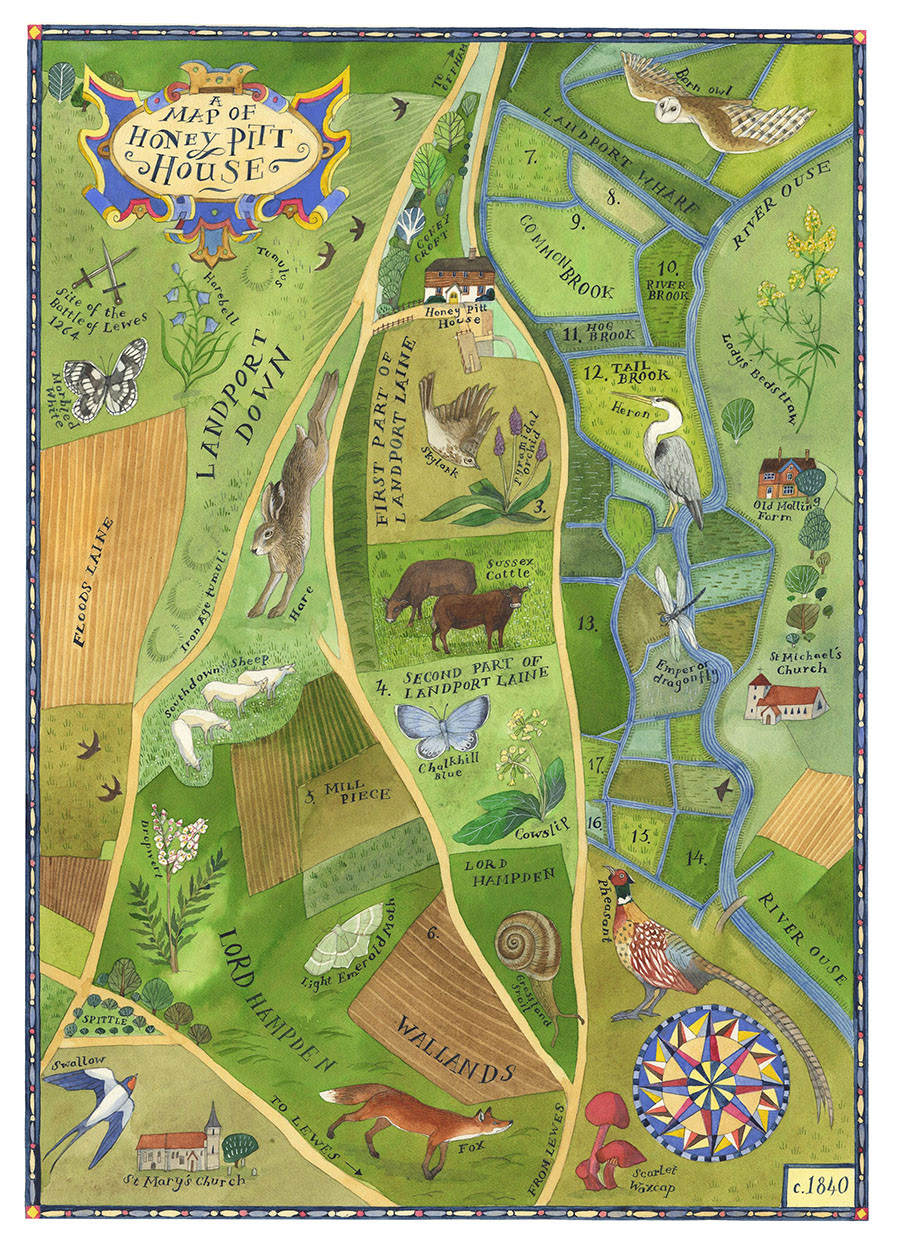
A privately commissioned map of the land around Honey Pitt House in Lewes, Sussex based on an original land map of the 1840s.
I used a selection of historic maps to inform the names of field parcels, land owners, ancient battle and burial sites and building features like churches and farms that would have been visible at the time. Alongside this, I added wildlife and traditional Sussex livestock found locally on the South Downs.
The painting is A3 in size and rendered in watercolour, gouache and acrylic ink with hand lettering.