
The De La Warr Pavilion in Bexhill is an icon of Modernist design. Built in the 1930s as a 'People's Palace', it continues to this day as a space for the wider community on the South East Coast showcasing worldclass artists and performers. I was asked to create a map mural for the Pavilion top foyer which reflected the connections between the building and it's environment - the physical connections but also creative, political and historical ones too.
Rather than looking back towards the town of Bexhill, I decided to look out of those huge modernist windows and map the sea instead, using an Admiralty Chart as reference. My map takes elements from the chart - the light vessels, undersea pipelines and buoys and the obscure names of rocks and reefs and sandbanks. But this maritime relationship is more than one of pure geography. Other symbols swim in the waters of my map too. The sea acts as inspiration for artists and architects reflected in the architecture and design of the De La Warr Pavilion itself. The sea is a border, constantly washing up visitors - invaders, tourists, immigrants, refugees and those seeking health from the sunny beach and waters of Bexhill. And of course Pevensey Bay is part of the UK National Marine Conservation Area and home to a multitude of other creatures like shellfish, crabs, seahorses and fish.
An unconventional map, perhaps, but one that I hope gives a broader view of the place and its many maritime layers.
The drawing was created in pen and ink and then transferred to archival wallpaper. It was also used to skin the Pavilion's Terrace Bar which stands at outside events selling refreshments. Limited edition prints are available to buy from the De La Warr Pavilion shop.
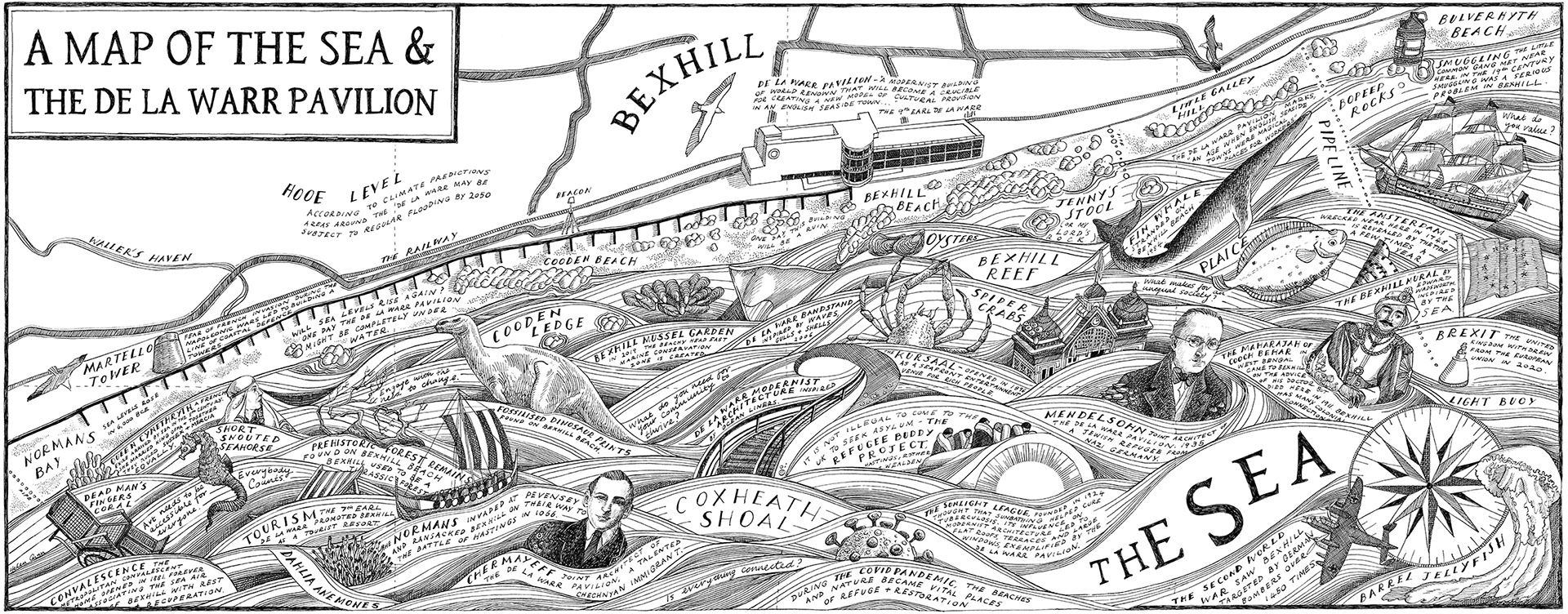
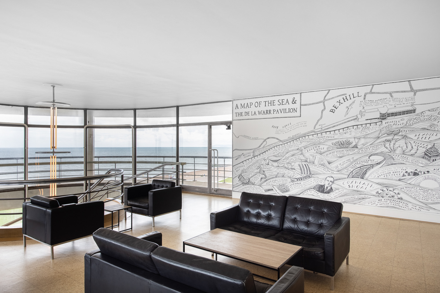
Photo by Rob Harris.
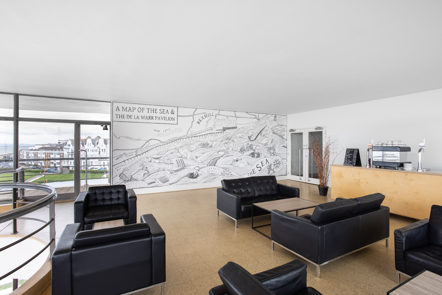
Photo by Rob Harris.
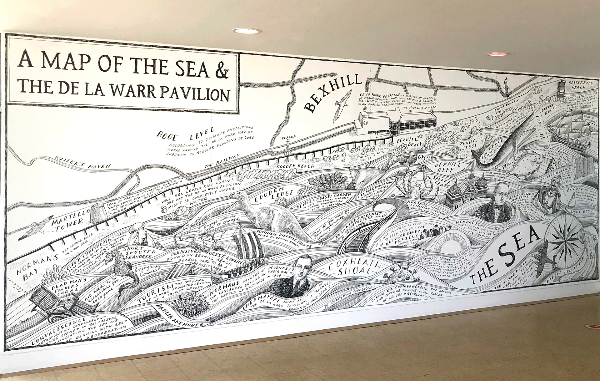
Photo by Matthew Coombes.